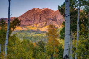
I backpacked to Lost Man Lake in the Hunter-Frying Wilderness this past weekend near Independence Pass. The weather was overcast for most of the trip, but the sun came out for two minutes at sunset. I was pleasantly surprised to see some wildflowers still blooming in the area. I also got some cool pictures of the area in the moonlight. If I only had a fishing rod with me I could’ve caught some of the trout swimming in the lake.
Trail Description to Lost Man Lake
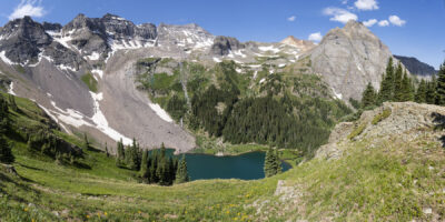
Lost Man Lake is reached by hiking 2.5 on a well-marked trail. The trail begins near the summit of Independence Pass at 11,200 feet. Views are constant as you while the trail. The trail ascends gradually for about the first 1.25 as it follows a stream through willow. As you climb out of the willow, the trail then steeply ascends towards the pass. The trail passes Independence Lake just before reaching the summit. The lake is a pretty spot to grab lunch or just take in the view. The trail then makes a short but steep climb to the top of the pass. The pass lies just past the two mile mark on the trail. After taking in a panoramic view of the mountains around you, descend a series of steep switchbacks to Lost Man Lake just on the other side of the pass. There are a few camp spots near the far end of the lake and camping is plentiful as the trail descends into the valley below the lake. Some hikes do a shuttle hike connecting back with the highway after 7 more miles of hiking. Or hikers can return the same way they came.
Directions
Take Independence Pass road (Hwy 82) from Twin Lakes, CO to the summit of Independence Pass (about 1/2 an hour). Then drive about 1 mile west of the summit and park at the large lot on the right side of the road at the bend in the road.