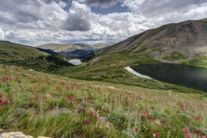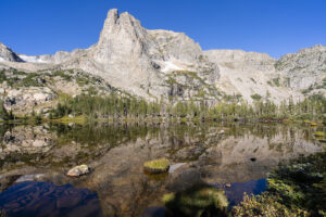
This week I hiked to Odessa Lake in Rocky Mountain National Park, a place I’d never been before. The hike starts at the Bear Lake trailhead, passing Lake Helene, and ending up at Odessa Lake. It is a beautiful but challenging 8 mile RT hike.
The first part of the trail follows Bear Lake and then quickly veers uphill after .2 of a mile. The trail climbs above Bear Lake and then veers sharply to the left. The lake is 3.6 miles from this point. For the next .5 mile, the trail heads steeply uphill through the pine forest. At this point, another trail junction makes a sharp left (toward the summit of Flattop Mountain). Ignore this junction and continue heading straight. The trail continues to climb. Soon, you will pass a clearing where views of the Mummy Range open up to the north. You will come to a large boulder field and avalanche chute that provides more open views.
The trees begin to thin at this point and views of the mountains to the west appear. The trail through this section is quite easy. The grade is only a gentle uphill slope. As views of the mountains open up, the trail makes a hard right turn. At this point (around mile 3.5), a small social trail to the left is visible. Take this trail and after .2 mile, Lake Helene awaits. It is willow choked around the shore but a few spots are accessible. Follow the indistinct social trail to the left and visit some of the open spots along the lake. Lake Helene is quite shallow so the reflections are amazing here.
After rejoining the main trail, continue heading north on the trail if you want to visit Lake Odessa. Here’s the bad news–the trail descends quite steeply about 600-800 feet to reach the lake. This means you will have to climb this steep and rocky slope on the return unless you through-hike to the Fern Lake trailhead and catch the shuttle back to Bear lake (this adds about 1-1.5 miles to the total hike). Odessa Lake is visible in a couple of spots as you descend. The trail passes the lake before backtracking to the shoreline.
Enjoy lunch at the lake! You will need to recharge your batteries before the steep uphill climb back to Lake Helene. This part of the trail took me about 45 minutes. Once you reach this spot, however, it all downhill from here. The entire hike takes about 5-5.5 hours.
I went to Jackson, WY to pick up some photographs that had been on display for the past year at St. John’s Hospital. While I was up in the area, I stopped at String Lake in Grand Teton National Park to catch the sunrise and then kayaked around Jackson Lake for a while. The next morning I stopped at Lake Marie and Mirror Lake in the Snowy Range on the way back to Colorado. What beautiful mornings. It was perfectly calm. The smoke from recent wildfires made the color really pop on the mountains!
Lake Marie, Snowy Range, WY
Below Lake Marie Falls, Snowy Range, WY
Mirror Lake, Snowy Range, WY
Sunrise, String Lake, Grand Teton National Park, WY
It is wildflower time in Colorado. The peak is just about past but there is still time to get out and enjoy the flowers. I did a short hike to Silver Dollar Lake and Murray Lake near the summit of Guanella Pass. The paintbrush were going crazy in the meadow between the two lakes. The hike itself is relatively short but is steep in sections. It is about 5 mile roundtrip. Most of it is above treeline as well. The views are amazing but oxygen is in short supply. The trail meanders through the forest for about 1.2 mile before veering left. It then switchbacks steeply above the private lake to your right. The flowers start in earnest along drainage areas about halfway up the trail. Enjoy!
Red paintbrush, Silver Dollar Lake, near Guanella Pass, CO,
Wildflowers, Silver Dollar Lake trail, near Guanella Pass, CO
Lake Murray, Silver Dollar Lake trail, Guanella Pass, CO
To get to the Silver Dollar Lake trail, take the Guanella Pass road out of Georgetown, Colorado. Head south until reaching the campground near the summit. The turn for the trailhead is just past the campground and just before a steep switchback in the road. A parking area is on the right. Vehicles with a little clearance can easily make the higher parking lot about .75 mile up the road. Park before you reach the Naylor Lake lodge.
I’ve had the Alice Lake/Toxaway Lake loop hike in the Sawtooth mountains of Idaho on my bucket list for a number of years now. I finally got to do the hike this past week. It was well worth the wait. My son and I spent three days in the wilderness here. The hike has any number of features a photographer could want–beautiful alpine lakes, gorgeous waterfalls, and some midsummer wildflowers. It also has a number of lakes stocked with brook trout. The trail is located about 20 miles from Stanley Idaho or 50 miles north of Sun Valley.
Trail Description
The trailhead starts near the Petit Lake campground. In about 1/4 mile, the trail splits–go straight to Alice Lake or veer right to Toxaway Lake. I choose the Alice Lake route because the Toxaway trail can be steeper in portions going in the uphill direction. The Alice Lake trail is fairly benign for its first 3 miles. Not too bad for carrying a 40 pound pack. Around mile 2.5, you come to the first of 6 stream crossings. The crossings either have to be waded or you can look for logs that have been placed across the stream by other hikers. In July, the stream crossings weren’t too bad and we found logs just upstream from the main crossings in all cases. After the second stream crossing, the fun begins. The trail climbs steeply above the creek and switchbacks up the hillside. The trail goes through a rocky section and features a few nice fields of Mariposa lilies. Up in Idaho, these flowers are white with purple centers as opposed to green ones found in Colorado. The trail continues to zig zag through the forest and finally comes to a bridge at crossing number 5. The last crossing brings you across the lake outlet and to your probable destination for the night–Alice Lake. Alice Lake has a number of good camping sites along its shoreline that borders the trail. Two arms jut out into the lake each of which has several camping spots. The second makes for a great spot to shoot the sunrise from. At least 4 peaks surround the far side of the lake and light up a brilliant orange at sunrise and are reflected in the calm waters of this part of the lake. Alice Lake has a decent fishing for brook trout although it is shallow in many spots (great for reflection photography but not so good for growing big trout).
If you follow the shoreline of Alice Lake to the end of the lake off trail, there is a small creek emptying in to the lake. There are some spots to get good waterfall photos here. Backtracking to about mid lake to rejoin the trail, the trail begins to climb high towards Twin Lakes. This pair of lakes lies about 1 mile farther up from Alice Lake. The trail continues up to the pass or drops about 100 feet to the lakes to the left. You can also camp here if you choose. It is not quite as scenic as Alice Lake but is beautiful nonetheless. Twin Lakes also sports much better trout fishing than Alice Lake. Above Twin Lakes, the trail climbs steeply up to the pass. From the top of the pass, you get commanding views of the Twin Lakes basin as well as the Toxaway Lake basin. Savor the view here before descending steeply to a couple of unnamed lakes just below the pass. We stopped for lunch along the shore of the larger of the two lakes. Below this lake, the trail passes by the creek which descends over the light colored granite in a series of cascades. These made for some gorgeous waterfall photos. The trail crosses the creek just below one of the large falls and skirts the opposite short of Toxaway Lake. My advice is to continue just past Toxaway to camp. there is also a good site just before the waterfall above the lake. The trail veers about 1/2 mile above the shoreline for much of the lake. The terrain is also rocky and steep. There are a few camp sites off a spur trail below the junction with the Edna Lake trail. This leads to an arm that juts out into Toxaway Lake about halfway around the lake that contains a few camping spots. We did camp here, but the walk back to the main trail was long and the mosquitoes were awful here. The worst I have seen outside of Alaska.
Below Toxaway Lake, the trail passes a couple of small tarns and the pretty Bowknot Lake. There is a large cascade at the back of one of the tarns but it was difficult to reach. I had to hop logs and negotiate a large marsh to reach the falls. It was pretty but harder to get to than it looked. From Bowknot, the trail descends steeply through a rocky boulder field and avalanche zone as it makes its way to Farley Lake. The trail passes by a large waterfall just past the boulder field. A short spur trail brings you to the base of the waterfall but several large bushes block the view from being better than it is. Back on the main trail, you will pass a large field of wildflowers before reaching a view of Farley Lake. The trail is a good 1/4 mile from the shore, so while people do camp here, it is an effort to reach the sites.
The trail once again descends rapidly for the next couple of miles before coming to the last major obstacle–a crossing of the creek. This one wasn’t logged, so we had to deboot and wade. It was rather easy but a minor inconvenience still. After another mile of walking the flats along the creek, you come to a junction with the spur to return to Petit Lake. After 17.5 miles of hiking, here’s the bummer with hiking the trail in this direction–you have to ascend the mountain 500 feet to the right and then descend it 500 feet to reach Petit Lake. It was the last thing I wanted to do on a hot afternoon, but I grudgingly made it up and over the small mountain. Two long series of switchbacks get you up the mountain. The descent is even steeper going down to Petit Lake so maybe I wasn’t so disgruntled with my choice of going to Alice Lake first. At long last, we reached the shores of Petit Lake at the end of our three days in the Sawtooth Recreation Area.
One word of caution: don’t expect to be able to get a spot in a campground in the Sawtooth Recreation Area without a reservation well in advance of your trip. Reports were that Redfish Lake fills in January and we did not find a spot in the campgrounds around Petit or Altura Lake either. All hope is not lost, however, as there are several dispersed camping spots in the area, including several along the Salmon River.
Sunrise, Alice Lake, Sawtooth Wilderness, ID
Alice Lake
El Capitan, Alice Lake, Sawtooth Wilderness, ID
View after creek crossing #4, Alice Lake trail, Sawtooth Wilderness, ID
Mariposa Lilies, Alice Lake Trail, Sawtooth Wilderness, ID
Twin Lakes, Sawtooth Wilderness, ID
Brook trout, Twin Lakes, Sawtooth Wilderness, ID
Snowy side Pass, Alice Lake/Toxaway Lake Loop, Sawtooth Wilderness, ID
Twin Lakes view, Sawtooth Wildernress, ID
Sunrise, Toxaway Lake, Sawtooth Wilderness, ID
Yellow Belly Creek, Toxaway Lake trail, Sawtooth Wilderness, ID
Toxaway Lake Outlet, Sawtooth Wilderness, ID
Cascade, Toxaway Lake Trail, Sawtooth Wilderness, ID,
Yellow Belly Creek, Toxaway Lake trail, Sawtooth Wilderness, ID
Wildflowers below Farley Lake, Sawtooth Wilderness, ID
Getting There
Petit Lake is located 17 miles south of Stanley off of Highway 75. It is about a two-hour drive from Twin Falls, Idaho. The trailhead is found the end of the campground. There is a large parking lot to accommodate the growing number of hikers on this trail. You will need to fill out a free permit at the wilderness boundary to hike here (and yes a ranger checked my permit on day 3 so do stop to fill out one).