My wife and I just did a backpacking trip to Alaska Basin on the west side of the Tetons. The trip is not in Grand Teton National Park, but that makes it better in my opinion. There are no permits needed for the region and the scenery is just as iconic. The trail features several cascades, great wildflowers, and terrific mountain views. Alaska Basin contains several small ponds and lakes that make for some great photography.
The trail starts at the South Teton Canyon Trailhead east of Driggs, Idaho. The first 2 miles meanders by the creek and is fairly flat. Then the fun starts. The trail climbs steadily through four or five meadows that filled with wildflowers. The views of the surrounding mountains are good as well here. At mile 2.7, the trail intersects with the trail to the Devil’s Stairs on the right. This side trail makes a loop with the main trail up at the basin if you so desire. We met several people doing the entire 16 miles in a day. The main trail continues steeply upward from this point. It climbs above the creek and enters a pine forest. Around mile 4.5, the trail ascends steep switchbacks and arroiuves at a meadow filled with columbine and cow parsnip. The trail levels off at this point and crosses the creek at mile 5.4. This crossing is a little tricky, especially on the way back. Watch for loose logs and rocks. There are two very nice cascades in this area as well.
Starting at the 6 mile mark, the trail again ascends some rock stairs and arrives at a small meadow. Some nice views can be had here and there are nice fields of wildflowers in abundance. You can also see a large waterfall in the distance here. The trail then renters the forest and climbs up to the junctions with the Hurricane Pass trail at mile 7.7. This is where Alaska Basin lies. We day hiked this side trail but did not quite make it to the pass. This trail steeply climbs a rock bench to Sunset Lake with stunning views from above the lake. The route up to the pass is filled with wildflowers past the lake. Hurricane Pass provides panoramic views but I wimped out.
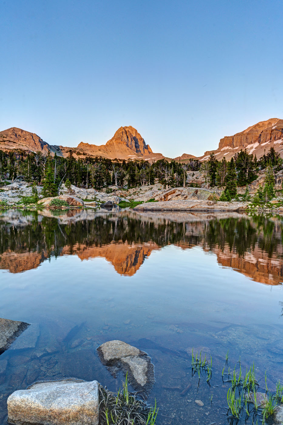
Back in Alaska Basin, we camped near one of the small lakes. Mirror Lake is the biggest of the six or so lakes in the area and is the most photogenic in my opinion. It also gets the most campers. The trail divides .1 mile past the junction with the Hurricane Pass Trail. Rather confusingly, the trail for Mirror Lake is signed as the left branch, but Mirror Lake is actually more easily accessed by the right branch trail to Mt Meek Pass. No matter. Each of the lakes has a little different view and is worth exploring.
One of the amazing features of this valley is that the sun has very little blocking it as it sets to the west. Thus, the mountains behind the lakes light up and turn amber and red in the evening light. It is quite a sight to behold. The back side of South Teton dominates the scene.

Mirror Lake Panorama, Alaska Basin, South Teton Canyon Trail, WY

Mirror Lake Panorama, Alaska Basin, South Teton Canyon Trail, WY

Wildflowers, South Teton Canyon trail, WY

Wildflowers, South Teton Canyon trail, WY

Wildflowers, South Teton Canyon trail, WY

Cascade, South Fork Teton Creek, South Teton Canyon Trail, WY

Cascade, South Fork Teton Creek, South Teton Canyon Trail, WY

Cascade, South Fork Teton Creek, South Teton Canyon Trail, WY

Cascade, South Fork Teton Creek, South Teton Canyon Trail, WY

Wildflowers, South Teton Canyon trail, WY

Wildflowers, South Teton Canyon trail, WY


Sunset Lake, Hurricane Pass trail, WY

Sunset Lake, Hurricane Pass trail, WY

Wildflowers, Hurricane Pass Trail, WY

Wildflowers, Hurricane Pass Trail, WY

Wildflowers, Hurricane Pass Trail, WY

Wildflowers, Hurricane Pass Trail, WY

Wildflowers, Hurricane Pass Trail, WY

Reflection, Alaska Basin, South Teton Canyon trail, WY

Reflection, Alaska Basin, South Teton Canyon trail, WY

Reflection, Alaska Basin, South Teton Canyon trail, WY

Mirror Lake reflection, Alaska Basin, South Teton Canyon trail, WY

Reflection, Alaska Basin, South Teton Canyon trail, WY

Reflection, Alaska Basin, South Teton Canyon trail, WY

Reflection, Alaska Basin, South Teton Canyon trail, WY

Sunset, Alaska Bain, South Teton Canyon trail, WY
Getting There
Take Highway 22 west of Jackson, WY to Victor, Idaho. The road becomes Highway 33 in Idaho. Follow the road north to Driggs. Turn right on Ski Hill road and follow it about 5 miles. Turn right onto Teton Canyon Road. Follow the dirt road for about 4.6 miles until it dead ends at the South Teton Canon trailhead.